.png)
Plan smarter. Fly safer.
Spend less.
All-in-one flight planning with real-time weather, fuel prices, and live airport data - no more juggling apps or phone calls.

Plan with Confidence
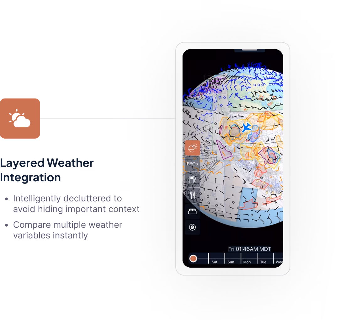
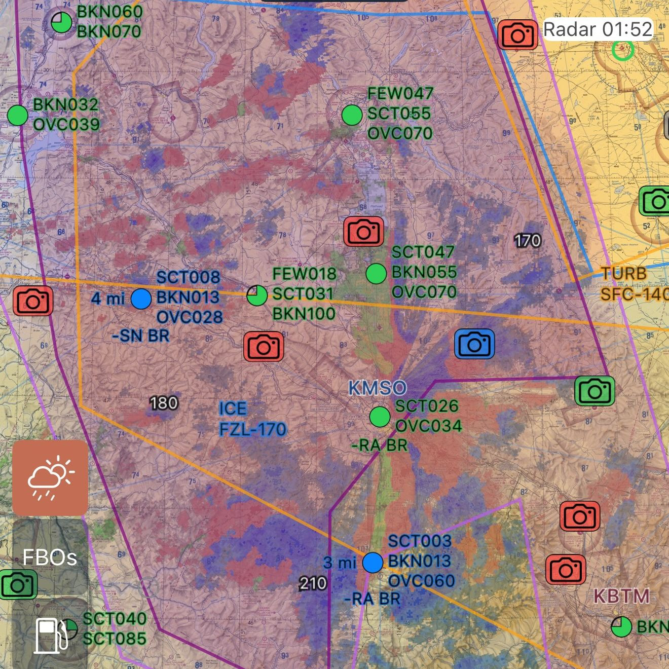
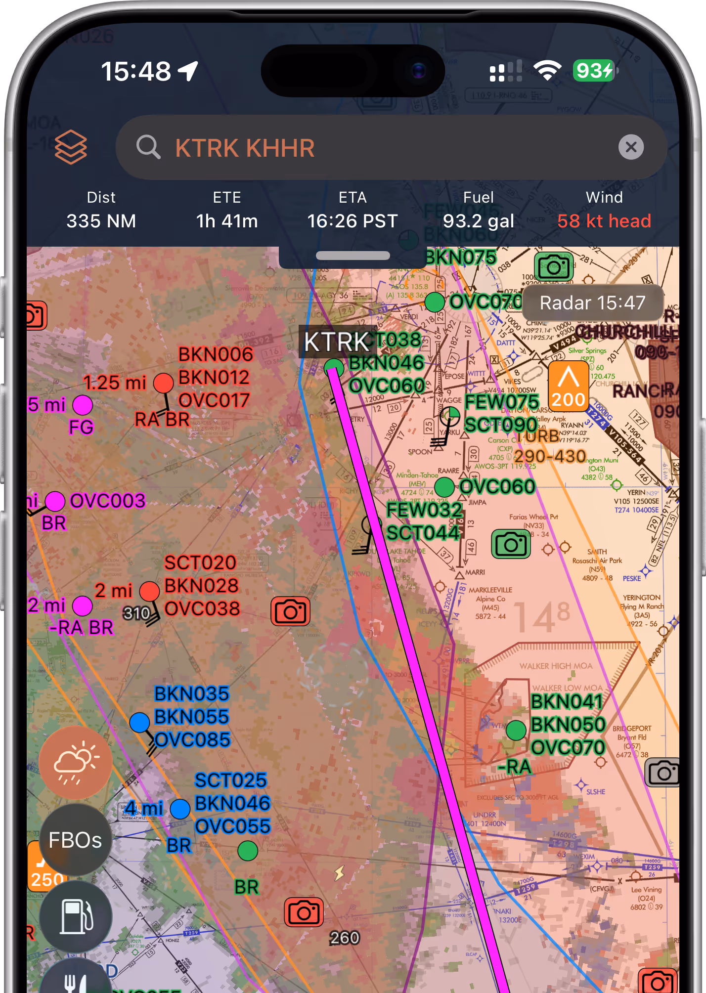
Smart, Context-Aware Weather Layers
Intelligently decluttered to present the most relevant information all at once — no more toggling 10 layers while zooming to get the full picture
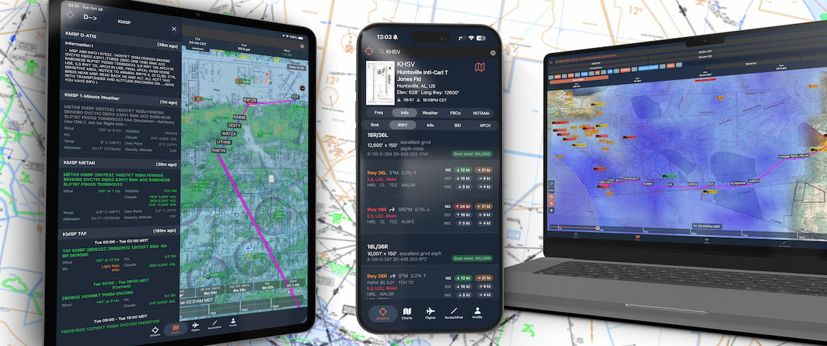
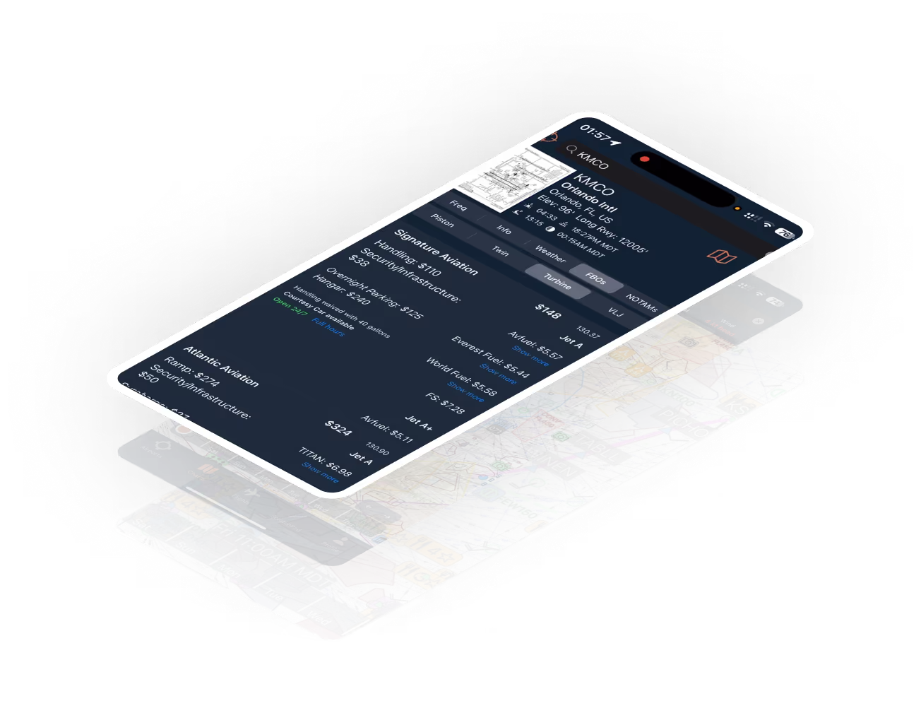
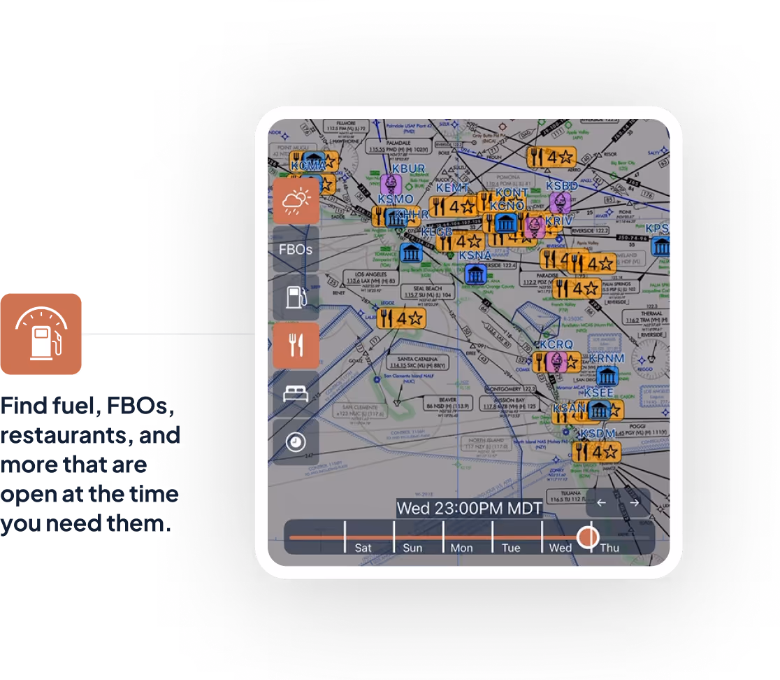
Live Airport Intel
One-minute AWOS, digital ATIS, open/closed FBO status, realtime fuel and FBO prices, restaurant walk times, and more.
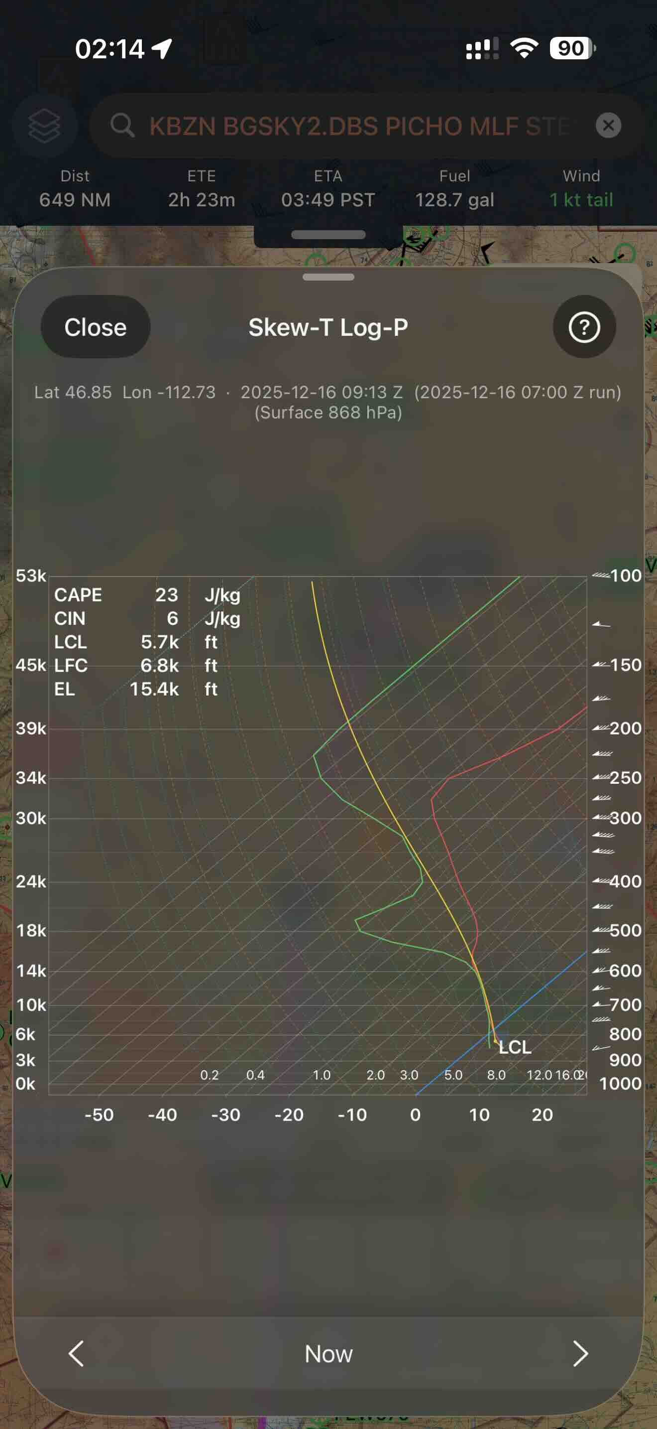
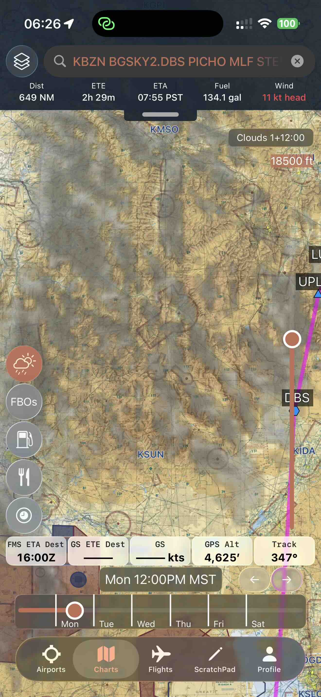
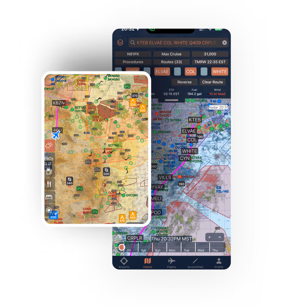
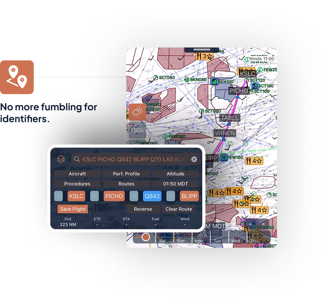
Proactive Route and Trip Planning
Overlay weather, hazards, and airspace in real-time — with autocomplete.
Works Seamlessly with Starlink
Just place a Starlink Mini under your windshield or mount it to a rear/side window.
.png)


Why Pilots Choose 8Flight
Features

Everyone Else
AI Weather Layer w/ FAA Weather Cameras, etc
Accurate Fuel Prices
Accurate FBO Fees & Hours
Restaurants, Hotels, Museums, Fly-Ins
Forecasts on the Map
Realtime Radar, Satellite, AWOS
All AIRMETs/SIGMETs
Offline/Inflight Flight Planning
Offline/Inflight Forecasts
High Resolution Maps
10x Faster
Full IFR Price
More Coming Soon
Trusted by Pilots Everywhere
The Most Affordable EFB
Buy your time back. Get off the phone, go fly.
Perfect if you want better real-time flight data to use alongside your existing EFB or panel.
- Real Airport Data
- Advanced Mappable Weather
- 7-day hourly graphical forecasts
- Fastest Updating, Most Complete Weather
- Readable VFR Charts
- Route Planning
- TFRs / NOTAMs / Airport Info
Your all-in-one VFR/IFR EFB — more features, less hassle, and no overpriced extras.
- 8Flight Data, plus...
- One-Touch Planning & Filing
- IFR Charts / Procedures
- Weather-Aware Routing (soon)
- Pro Performance Profiles (soon)
- ADS-B / Synthetic Vision (soon)
- Weight & Balance (soon)


We’ve Got Your Back
Our pilot support team is always ready to help with planning, tech questions, or feature tips.
.png)
Plan in seconds. Fly with confidence.